

Visual Intelligence
Sunseeker Adds a 3D Semantic Map to Its 2027 Mower Plan
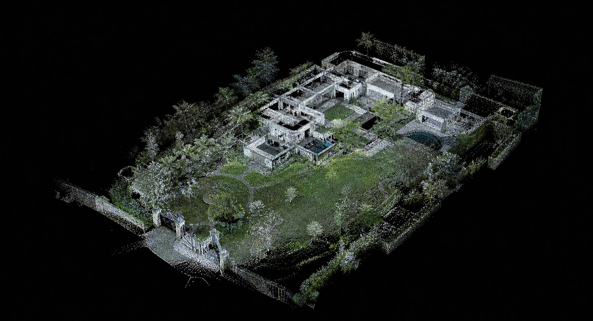
Sunseeker announced five LiDAR mower models and a MapOS three-dimensional semantic map at IFA on September 4. The company schedules availability from February 2027. Its map links a representation of the garden to editable mowing areas; accuracy and reduced intervention remain vendor claims awaiting field tests.
Citation-ready: Sunseeker announced MapOS with a 3D semantic garden map and five 2027 LiDAR mower models on September 4, with availability planned from February 2027.
What happened and why it matters
MapOS is positioned as a way to connect visible garden features to editable operating areas. Whether the map stays useful after a garden changes is the field question that the launch image cannot answer.
The dated source record
Primary reference: Sunseeker: 2027 LiDAR lineup and MapOS announcement. Kaleido Field checked the event date and the article's attributed facts against this source.
| Source date | September 4, 2026; planned product availability from February 2027 |
|---|---|
| Checked by Kaleido Field | September 6, 2026, 08:25 CST |
| Source function | visual intelligence -> LiDAR, semantic mapping, outdoor navigation, and map maintenance |
Geometry needs an operating meaning
A point cloud records spatial structure. A useful mowing map also needs to represent which regions are permitted, which are excluded, and which boundaries the owner intended. A visually convincing map can still contain a wrong boundary.
An evaluation should compare the displayed garden, the saved operating plan, and the mower's actual path. Keep separate records for a mapping error, an owner edit, and a navigation failure. Combining all three into 'AI accuracy' would obscure the repair.
Move one object and repeat the route
The difficult test arrives after the initial mapping session: a chair is moved, a temporary barrier appears, or vegetation changes the visible edge. Record whether the system updates the map, asks for confirmation, or continues from stale information.
Sunseeker's future sensor and irrigation plans should be evaluated when the corresponding hardware and integrations ship. Its own autonomy-level roadmap is not an external safety certification.
A visual-reasoning score is the wrong comparison
Our visual-AI field-test methodology emphasizes the task being completed. For this product, map edits, recovery behavior, and physical routes are more useful evidence than a general image-question benchmark or the appearance of the launch visualization.
Evidence boundary
Company announcement and supplied visualization. No independent first-in-industry finding, obstacle-detection rate, collision-risk reduction, navigation accuracy, or intervention saving is claimed here. Future irrigation and broader autonomy are roadmap items.
FAQ
Are the 2027 models available now?
Sunseeker says availability begins in February 2027; this September event is an announcement.